A powerful line of severe thunderstorms tore through southeastern Texas early Saturday, leaving more than a quarter-million residents without power and prompting urgent warnings from the National Weather Service. The Houston metro area bore the brunt of the storm, with wind gusts topping 60 mph and rainfall rates that threatened dangerous flash flooding.
Houston Wakes to Chaos
As dawn broke on October 25, over
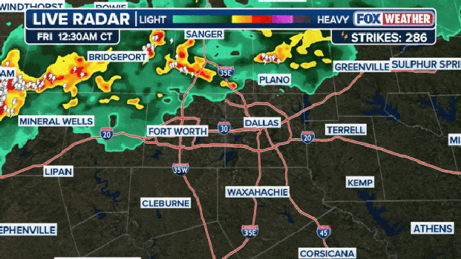
260,000 customers across southeastern Texas were in the dark, with more than 150,000 outages concentrated in Houston alone. Residents reported skies lit up by near-constant lightning and streets quickly inundated by torrential rain. According to the National Weather Service, wind gusts reached 59 mph in Downtown Houston and an even more intense 64 mph in Hempstead.
“Rainfall rates in the strongest storms could exceed 2-3 inches per hour, which could lead to flash flooding if these rainfall rates occur for a prolonged period of time,” warned NWS forecasters in Houston.
Warnings and Watches Blanket the Region
The National Weather Service issued a Severe Thunderstorm Watch for the region in the early morning hours, with warnings for damaging winds, large hail, and the potential for tornadoes. By mid-morning, Flood Watches covered much of eastern Texas, including Houston, as forecasters predicted widespread rainfall totals of 2-4 inches, with isolated pockets seeing as much as 6 inches.
A second round of severe weather was expected to energize later Saturday, keeping the region on high alert. The severe weather risk zone stretched from southeastern Texas across southern Louisiana, including major cities like Houston, Austin, and New Orleans. The threat included not only damaging winds and flash flooding, but also the possibility of tornadoes and hail larger than golf balls.
What Residents Need to Know
Authorities urged residents to stay indoors, avoid flooded roadways, and monitor local alerts. Emergency management officials recommended having an emergency kit ready, including flashlights, batteries, and enough food and water for several days, as power restoration could take time in the hardest-hit areas.
For those in the path of the storms:
-
Postpone outdoor activities until the threat passes.
-
Monitor local news and weather apps for real-time updates.
-
Prepare for additional outages as more storms are expected through Saturday night.
Severe Weather Moves East
While the severe weather threat was expected to diminish in Texas by late Saturday evening, forecasters warned that the line of storms would continue moving east into Louisiana and the Gulf Coast states overnight and into Sunday. Residents in those areas were advised to remain vigilant and prepare for similar hazards.
Expert Commentary
Meteorologists point to a combination of warm, moist air and a strong cold front as the drivers behind this weekend’s volatile weather.
“This is classic fall severe weather for the Gulf Coast—fast-moving storms, high winds, and the ever-present risk of flash flooding,” said a local weather expert.
Takeaways and Next Steps
-
Power restoration efforts are underway, but could be hampered by ongoing storms and flooding.
-
Stay informed: Sign up for local emergency alerts and have multiple ways to receive warnings, including NOAA Weather Radio and mobile alerts.
-
Prepare for more storms: The severe weather season is far from over, and residents across the Gulf Coast should review their emergency plans now.
Stay tuned for updates as the situation develops and follow official channels for the latest safety information.
Sources
1. Severe Thunderstorm Watch issued October 25 at 1:38AM ...
2. ny-alert
3. 260000 without power in Texas as severe thunderstorms ...
4. Text Based Forecasts
5. Severe storms possible for southern and eastern Australia
6. Severe Thunderstorm Warning for most of Houston area
7. List: Severe weather alerts in Southeast Michigan on ...